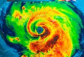
After the devastation of last year’s Hurricane Sandy, officials at the National Oceanic and Atmospheric Administration’s National Hurricane Center took a good hard look at how they did their jobs during the crisis.
Their conclusion? Not so hot. Weather Underground blogger Bryan Norcross, a hurricane specialist at the Weather Channel, sums up (“Hurricane Sandy Assessment – The Rest of the Story“): “The Sandy forecasts from the National Hurricane Center were excellent, but the forecast-communications process was confusing.” Norcross concurs: “In spite of thousands of highly skilled people in the National Weather Service, emergency management, and throughout the weather-forecast communications system going full tilt, the information reaching mayors, emergency managers, broadcasters, and coastal residents was at times unclear, conflicting, and hard to find. In short, the system let us down.”
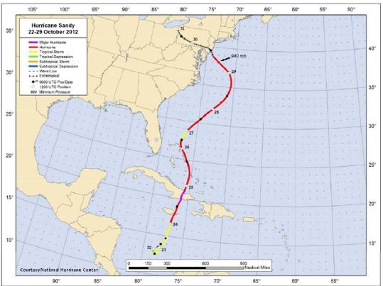
The NOAA “Service Assessment” is posted online as a PDF (“Hurricane/Post-Tropical Cyclone Sandy, October 22–29, 2012“). The report hightlights a critical failing in one area: informing the public about the risk of storm surge flooding. From the report: “The highest priority need identified by NOAA/NWS customers and constituents is for improved high-resolution storm surge forecasting and communication. In particular, there is a crucial need for storm surge graphical inundation guidance. Seventy-nine percent of coastal residents surveyed in March 2013 said the impact of Sandy’s surge in their area was ‘more than they expected.'”
Now the agency’s working on improving its performance. USA Today reports that the NOAA is developing a storm-surge prediction graphic tool, which would let people see the expected flood level displayed on maps via local TV broadcasts or Internet websites (“New forecasting tool eyed for hurricane season,” AP video). “2012 was all about water,” says National Hurricane Center spokesman Rick Knabb. “It was storm surge from the ocean, it was inland flooding.” Knabb says the center is working on an experimental graphic to show where storm surge is a danger as storms approach the coast. The graphic won’t be ready by the time hurricane season starts, the report says, but officials hope to have it ready before the season reaches its peak.