Late summer is time for relaxing on the beach, as vacation days draw to an end. But don’t start relaxing about hurricane readiness, experts warn: The busy time for hurricanes is still ahead, and all indications still point to an active season. “As we stand on the cusp of the peak part of hurricane season, all of the major groups that perform long-range seasonal hurricane forecasts are still calling for an active 2013 Atlantic hurricane season,” reports Jeff Masters in his Weather Underground blog (“An Active Atlantic Hurricane Season Still Predicted by NOAA, CSU, and TSR“).
In an August 8 announcement (“NOAA Atlantic Hurricane Season Outlook Update“), the National Oceanic and Atmospheric Administration says, “The outlook indicates a 70% chance of an above-normal season, a 25% chance of a near-normal season, and only a 5% chance for a below-normal season.”
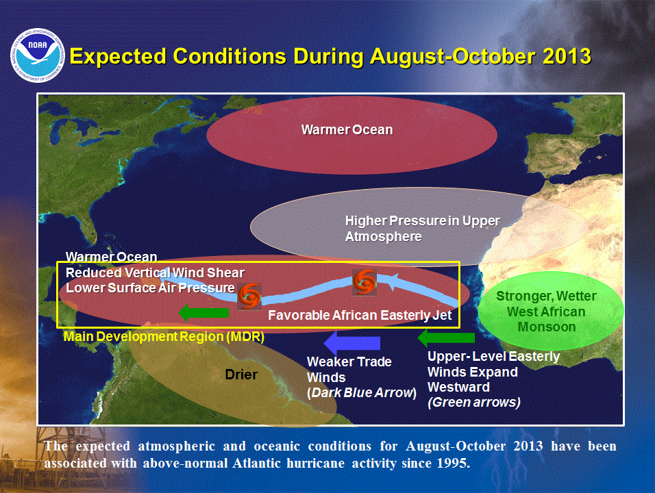
NOAA cites five main factors in warning of a busy season, notes Masters:
- Sea Surface Temperatures (SSTs) are above average in the Main Development Region (MDR) for hurricanes, from the coast of Africa to the Caribbean. As of August 9, SST were 0.4°C (0.8°F) above average;
- Trade winds are weaker than average across the MDR, which has caused the African Monsoon to grow wetter and stronger, the amount of spin over the MDR to increase, and the amount of vertical wind shear to decrease;
- No El Niño event is present or expected this fall;
- There have been two early-season tropical storms in the deep tropics (Tropical Storms Chantal and Dorian), which is generally a harbinger of an above-normal season; and
- We are in an active hurricane period that began in 1995.