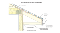
Portland, the largest city in Maine, is a busy port built on a peninsula. The city’s “working waterfront” is an active commercial zone as well as a tourist attraction and a center of night life. But in the coming decades, that waterfront is threatened by rising sea levels. If even the mid-range predictions for sea level rise come to pass, areas at the water’s edge will flood.
Scientist Peter Slovinsky analyzed a hundred years of tide-gauge data from the Portland harbor recently, and reported that sea levels in the area have been rising the whole time. But in recent decades, the rise has accelerated, Slovinsky said. The Portland Forecaster had the story in July (“Maine marine geologist: No mistaking rising sea level,” by Ben McCanna).
Reports the Forecaster: “In the past 20 years, sea-level rise has sped up to a yearly average of about 3.5 millimeters, which is faster than any period during the past 5,000 years, Slovinsky said … The rising water could prove disastrous. In Portland, for instance, flood stage is 12 feet. According to 2011 statistics, flood stage was exceeded in Portland 11 times, or 1.6 percent of all tides. If the average sea level had been a foot higher in 2011, flood stage would have been exceeded 100 times, or 14 percent of all tides. If sea level had been two feet higher, flood stage would have been exceeded 300 times, or 40 percent of all tides, Slovinsky said.”
Portland is considering its options, reports the Portland Phoenix (“Portland plans for action in the face of rising seas and bigger storms,” by Jeff Inglis): “By the turn of the next century, most of the areas of Portland that were filled in during the 1800s to create more land downtown will be either underwater or regularly flooded during storms We need to figure out what to do about that.”
The Phoenix story profiles the work of Sam Merrill, a professor at the University of Southern Maine and the president of Catalysis Adaptation Partners, a consulting firm focused on planning for sea level rise, coastal hazards, and extreme weather events. Catalysis is working on a report about the risks Portland’s low-lying Commercial Street faces in the 21st century—intended, the paper reports, “to kickstart a Portland Society for Architecture community-wide conversation about what actions public and private entities might take to avert, avoid, or at least minimize disaster.” Catalysis vice president Jonathan Lockman will present the company’s analysis at a November 7 symposium, “Waterfront Visions 2050.”
Catalysis’ approach is based on community engagement, the Phoenix reports. Says Merrill: “”We don’t need more data. We need more conversations.” But the work relies on a software package called COAST. Reports the Phoenix: “It is built on mathematical formulas developed by Paul Kirshen, a civil-engineering professor at the University of New Hampshire, coupled with three-dimensional imagery and modeling assembled by Hallowell-based Blue Marble Geographics.”
The Catalysis website says, “The COAST approach is not one where outside experts tell the community what assets are important to them, what the future holds in store for them, or what actions they should plan for.” Instead, says the site, “We use visualizations and a scenario-based approach …. Combining multiple future scenarios provides stakeholders an opportunity to select their expectation of future conditions and then visualize damages under action versus no-action scenarios.”
In practice, those discussions can get heated. As Merrill told the Phoenix: “”Going in and running those meetings is not for the faint of heart.”